Making Drone Survey Data Easy for Clients to View
Delivering drone survey data often means handing over large files that the client cannot open without specialised software. That creates friction, delays decisions, and can leave you spending time on support calls instead of on the next job. The goal is to give clients a way to review maps, orthophotos, elevation models and other deliverables in a browser, on any device, without installing anything.
The process involves organising the raw outputs, choosing a delivery method that keeps control with you, and setting permissions so each client sees only their own projects. When done well, the result is a straightforward experience that lets the client zoom, measure, compare and download what they need, when they need it. This is a clearer way to share drone surveys that many operators are adopting.
Step 1: Organise Your Deliverables into Job Folders
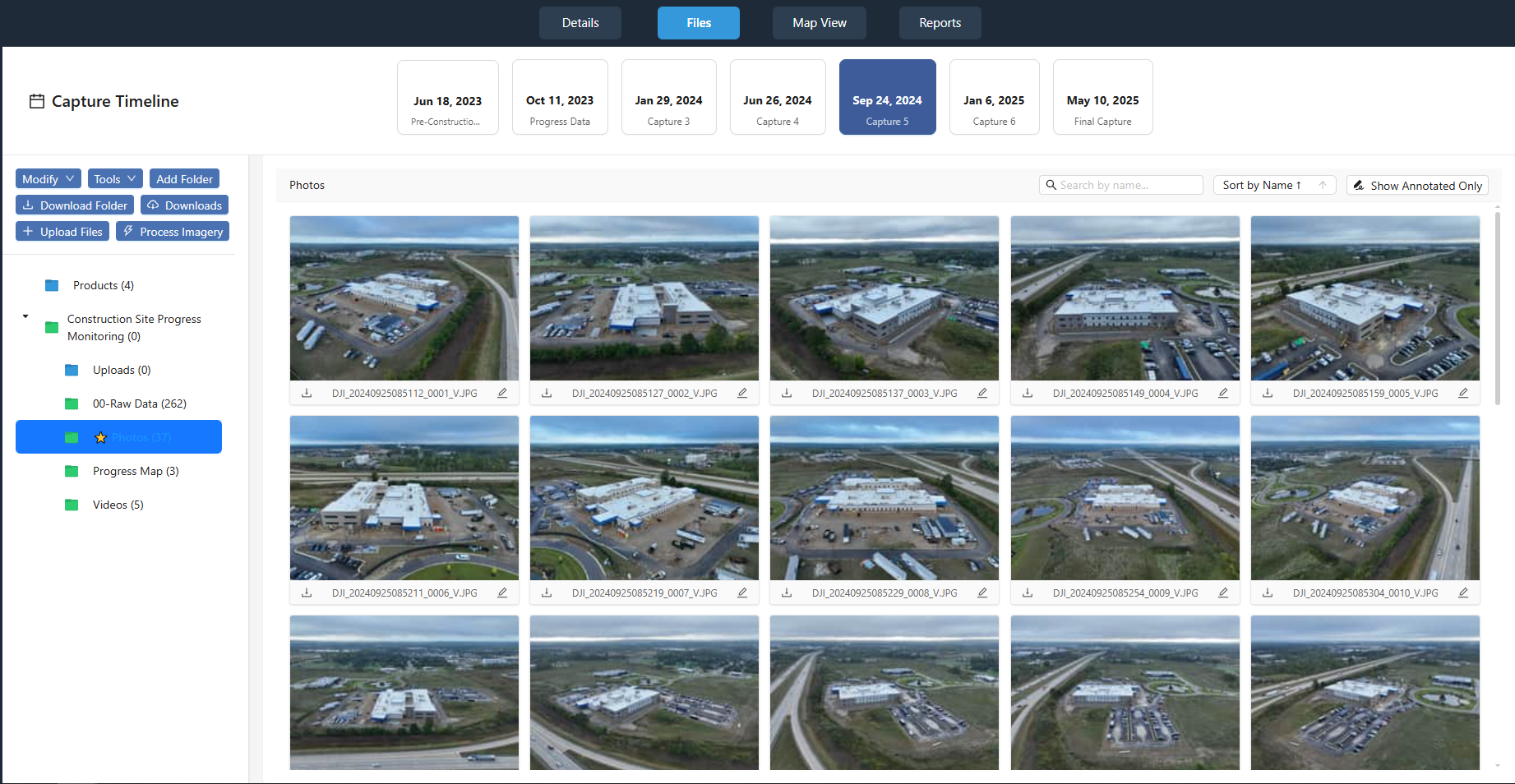
Before you upload anything, structure your files in a way that mirrors how the client thinks about the project. A simple folder hierarchy helps. Start with a top-level job folder named after the client and the project date or site name. Inside it, create subfolders for each deliverable type: orthophoto, digital surface model, point cloud, contour lines and so on.
What to watch: File naming matters. A file called "DSM_Johnson_Site_2024-09-15" is far more useful than "output_final_2.tif". Clients who are not drone specialists will appreciate names that match the terms on their own site plans. Keep folder structures consistent across projects so returning clients know where to look.
Step 2: Choose a Delivery Platform That Works in a Browser
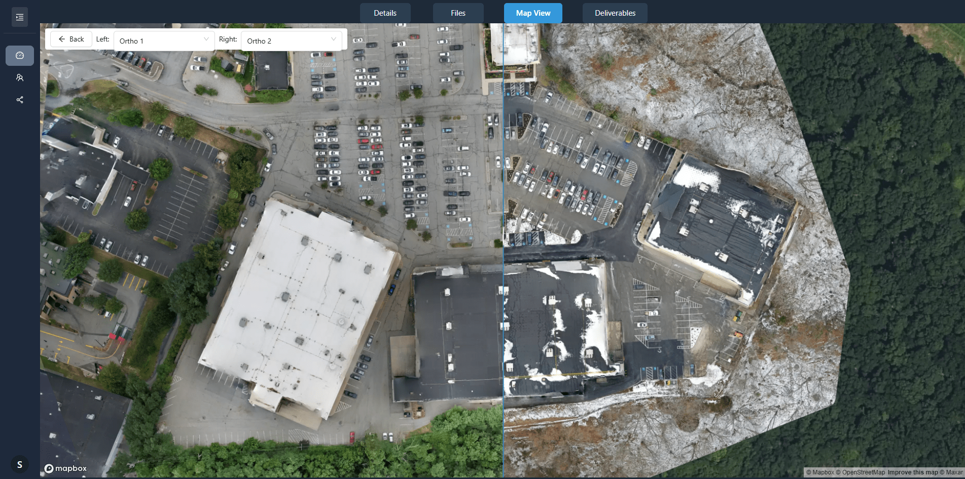
Not all drone data platforms are the same. Some require the client to download a desktop app or a mobile viewer. That defeats the purpose. Look for a platform that uses a standard web browser on desktop and tablet. The client should be able to open a link and see the data within seconds, without logging in through a corporate VPN or installing a plugin.
What to watch: Check that the platform supports the file formats you commonly produce. GeoTIFF, LAZ, JPG, MP4 and PDF are typical. The viewer should handle large raster files smoothly, with pan and zoom that feel responsive. If the platform chokes on a 500 MB orthophoto, the client will not have a good experience. Also confirm that the platform offers a share link that does not expire after a few days, unless you want that restriction.
Step 3: Set Download Permissions and Watermark Options
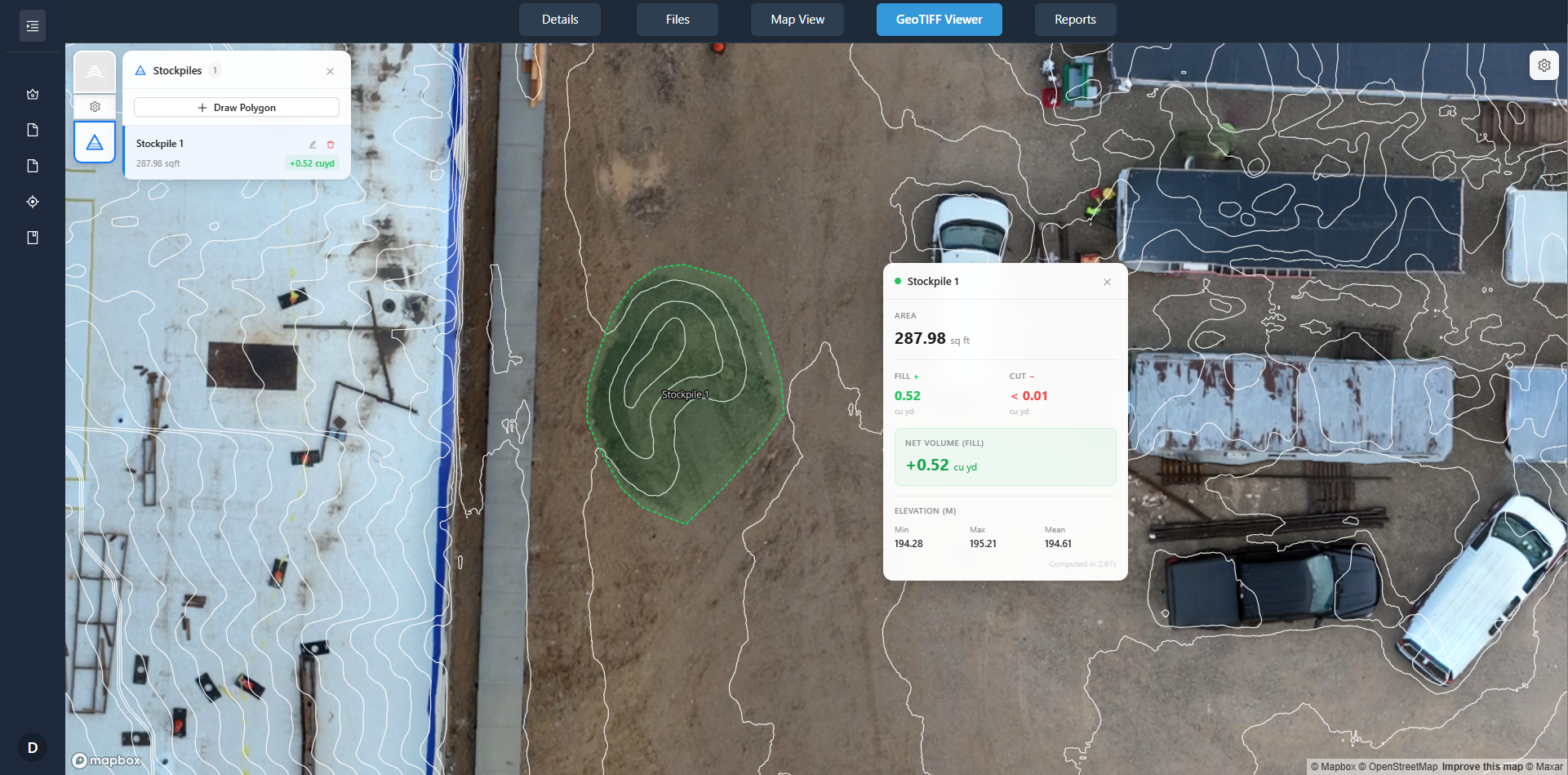
Once the client can view the data, you need to decide what they can do with it. Many platforms let you control whether the client can download the original files, export a screenshot, or only view. This is useful when you want to show a preview before final payment, or when the data contains sensitive information.
Watermarking is another useful layer. A subtle overlay with the client's name or the project date can discourage unauthorised sharing while still allowing full review. Some platforms let you remove the watermark for specific users or after a milestone is reached.
What to watch: Do not lock down everything so tightly that the client cannot do their job. If they need to pull measurements or export a section for a report, give them that permission. The best approach is to set default permissions per job folder and then adjust for individual users. That way you do not have to remember each client's preferences.
Step 4: Use a Client Portal for Ongoing Access and Tracking
A client portal is more than a file dump. It gives each client a dedicated space where they can see all their projects, view data, leave comments and track progress. For the operator, it provides access tracking: you can see who looked at what, when, and whether they downloaded anything. That information is helpful for follow-ups and for proving delivery in case of disputes.
What to watch: Keep the portal simple. Clients do not want to learn a complicated interface. The dashboard should list jobs by name and date, with a clear status indicator. A search or filter helps when a client has many projects. Avoid clutter such as news feeds or promotional banners. The portal is a tool for the client to get their data; everything else is a distraction.
Access tracking works both ways. If a client has not opened the link after a week, you can send a polite reminder. If they have viewed the data multiple times, you know they are actively reviewing it. That can guide your follow-up timing and help you close the project sooner.
Step 5: Prepare a Simple Share Link with Optional Password Protection
For smaller projects or quick reviews, a share link is often enough. Generate a unique URL that points directly to the job folder or to a single deliverable. Many platforms let you add a password or set an expiry date. For routine updates, such as progress photos during a construction project, an open link with no password is fine. For sensitive data such as infrastructure surveys, a password is prudent.
What to watch: Test the link from a device the client will use. A link that works perfectly on your desktop Mac may look broken on an older Windows tablet. Open it in an incognito browser window to see what the client sees. Also check that the link works on mobile browsers; many clients will open it on a phone while on site.
If the platform allows it, add a short description to the share link so the client knows what they are looking at. A link labelled "Johnson Site - Orthophoto - 2024-09-15" is more helpful than a random string of characters.
Step 6: Give the Client a Brief Orientation
Even with the simplest interface, a client who is not used to drone data may need a quick orientation. Send a short email or a one-page guide that explains how to navigate the viewer, how to take measurements, and how to download files if you have given that permission. Keep it friendly and jargon-free.
What to watch: Do not assume that the client knows what an orthophoto is or why the digital surface model looks the way it does. A one-sentence explanation in the email, such as "This map is a high-resolution photo that is geometrically corrected so you can measure distances accurately", goes a long way. The less the client has to ask, the more professional your service appears.
This approach is a clearer way to share drone surveys. It turns a potential support burden into a smooth handoff that builds trust. The client gets their data fast, they understand what they are seeing, and you get feedback quickly so the project can close. Setting up a consistent delivery workflow takes some initial effort, but once it is in place, every project follows the same pattern, and that saves time on both sides.